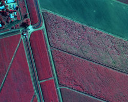
AGRICULTURE
Fit-for-Purpose Precision Agriculture Solutions
LRI are leading agricultural engineering consultants with an experienced team of agricultural, science and engineering professionals. We can support you with full turn-key solutions or provide project based interventions as your needs dictate. We challenge ourselves to find optimal agricultural engineering solutions to the South African agricultural industry. Typical agricultural engineering services include the following:
-
Aerial remote sensing and GIS services for precision agriculture
-
Land use mapping, assessing crop variability and performance tracking
-
Agri-business development, including conceptualisation, feasibility studies and turnaround strategies
-
Agricultural infrastructure, including roads, buildings and fencing assessment, design and project management
-
Livestock housing assessment, design and project management including feedlots and dairies
-
Wetland rehabilitation assessment, design and project management
-
Bulk water, irrigation and drainage assessment, design and project management
 |  |  |  |
|---|---|---|---|
 |  |  |  |
 |  |

